Queyras
Ski touring route

Rocherbrun - South east couloir

ski grade

4.1 PD E2

Dec - March

1375M

Ascent

1375M

Decent

45°

Gradient

3150M

High Point

1799M

Low Point

SE

Slope Aspect

10km

Distance Up

6km

Distance Down

SE

Slope Aspect

3537ET

Map IGN Number

No items found.

A big day out but worth it for a  stunning mountain line

Description:

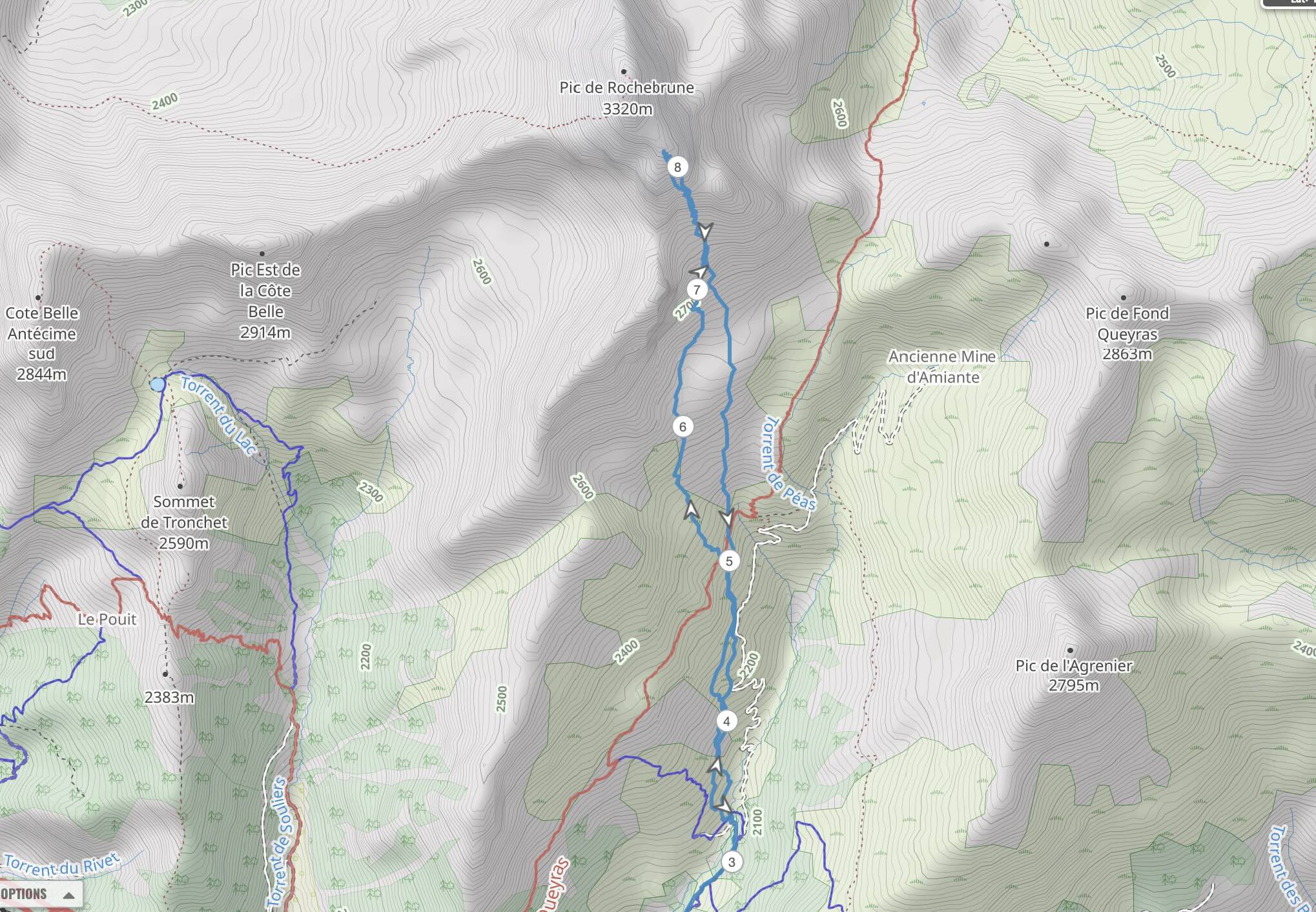
The parking is very depended on snow level. From the the village of les Meyries heading out on the GR58 variante forest track.

From where you park follow the GR58 northwards. We crossed the river just after the Bergerie and continued roughly following the gr58 variante. At some point head north towards Rocherbrun.

Climb the SE couloir. Near the top it splits in to some smaller couloirs, you want the middle one. Climb up as far as you can (quite rocky near the very top).

Descent.

Follow the route back down the way you came.

3537ET

Map IGN Number

The Collective

our sponsors

This guide would not be possible with out the generous support of our sponsors.

weather

See the latest Avalanche report

view report

meet our expert

Rob Benton

Meet the man behind the Collective.

learn more
Thank you! Your submission has been received!
Oops! Something went wrong while submitting the form.